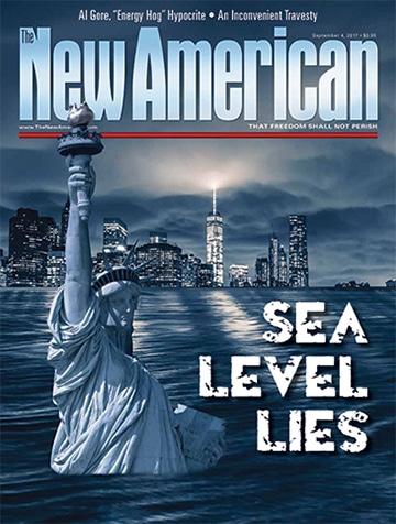

Sea Level Lies
Since President Donald Trump announced his intent to withdraw the United States from the globalist-spawned Paris agreement, climate alarmists have gone into apoplectic apocalyptic tailspin. After the president’s June 1 announcement, actor/activist Leonardo DiCaprio lamented that “today, our planet suffered.” Comedienne Bette Midler labeled Trump a “destructive megalomaniac.” Filmmaker Michael Moore tweeted that “Trump just committed a crime against humanity,” while billionaire environmentalist Tom Steyer spat, “The Trump Administration has just committed assault and battery on the future of the American people. There can be no excuse for this willful crime.”
Some are even calling for his impeachment over his stated intent to keep his campaign promise to the American people. Writing for the Huffington Post, Marjorie Cohn accused the president of committing a “High Crime.” This professor emerita at Thomas Jefferson School of Law said Trump’s move threatens “international peace and security” and the “very foundations of civilization.”
If that sounds slightly to the Chicken Little extreme, keep in mind that these radicals blame man-made climate change for increases in violent storms, farmland destruction, food shortages, floods, drought, heat waves, blizzards, insect-borne disease, and species extinction. For example, in 2005 the journal Science argued that “global data indicate a 30-year trend toward more frequent and intense hurricanes.” Happily, reality proved otherwise. No Category 4 or 5 hurricanes have affected the United States since 2005. Katrina was a Category 3 storm when she slammed into poorly protected Louisiana that year. (According to NASA, hurricanes are classified by wind speed, with Category 3 winds “similar, or close, to the serving speed of professional tennis players.”) New Orleans was set up for disaster, not from man-made climate change, but thanks to the federal government’s absurd insistence on developing residential areas in low-lying swamp land, while for decades neglecting necessary, Congress-sanctioned levee improvement.
The 2012 media-classified “Superstorm” Sandy was also Category 3 at its peak when it hit Cuba, but by the time it made U.S. landfall, NOAA’s National Hurricane Center had downgraded it to a post-tropical cyclone. As destructive as Sandy was, it was her storm surges combined with high tides that caused flooding across the Northeast. Though alarmists attribute her damage to man-made sea level rise, Sandy behaved as similar storms always have and always will: Offshore winds pushed water ashore. A few fractions of an inch in sea level rise pales in comparison to a 15-20 foot storm surge.
Alarmists are also fond of citing increases in extreme tornadoes. Wrong again! There has been a marked downward trend in “strong to violent tornadoes” since the 1950s, according NOAA. Tornado intensity is classified by the Fujita Scale, based on the measure of damage to buildings and vegetation. Severe storms are classed as F3 or greater, with wind speeds at least 158 miles per hour, while F5 twisters can top 300 mph. The national average number of F3+ tornadoes from 1954 to 1983 was 56.3, while the same average from 1984 to 2014 was 36.9. Moreover, NOAA’s list of “Ten Deadliest Documented Tornado Events” includes only one storm in the past 60 years: 2011 in Joplin, Missouri, which ranks seventh. The other nine occurred between 1840 and 1953. Additionally, the National Weather Service’s Storm Prediction Center reports that 17 Americans died in tornadoes last year. That’s the smallest number of fatalities in 30 years; the second fewest in more than 60 years.
And so it goes. In almost every case of alarmist hand-wringing, plain truth flies in the face of their panic-laced predictions. NOAA records show the upward trend in rainfall since 1895 has significantly slackened since 1976. So much for flooding. Also, droughts have become shorter, less frequent, and smaller in area. In July, drought in the United States fell to a record low, according to the U.S. Drought Monitor, a collaborative project of NOAA, the U.S. Department of Agriculture, and the National Drought Mitigation Center.
“Since 2013 the world and the United States have had a remarkable stretch of good fortune with respect to extreme weather,” noted environmental studies expert Dr. Roger Pielke, Jr., who testified before the U.S. House Committee on Science, Space and Technology in March. “The lack of evidence to support claims of increasing frequency or intensity of hurricanes, floods, drought or tornadoes on climate timescales is also supported by the most recent assessments of the IPCC and the broader peer reviewed literature on which the IPCC is based.” (The IPCC is the highly influential United Nations Intergovernmental Panel on Climate Change. Governments worldwide base their climate laws and regulations on the findings of regularly published IPCC assessment reports.)
But the greatest climate bogie in the alarmist arsenal is sea level rise. Catastrophic, irreversible, unstoppable — a few of the hysterical terms climate doomsayers use to describe this supposed threat to humanity. “Under the high emissions scenario, the 22nd century would be the century of hell,” claimed Ben Strauss of Climate Central, a government-funded-yet-self-proclaimed “independent” research group in New Jersey. Referring to a study published in the journal Nature earlier this year, Strauss told the Washington Post, “There would really be an unthinkable level of sea rise. It would erase many major cities and some nations from the map.” In January, NOAA predicted a sea level rise of as much as 8.2 feet by the year 2100. And who can forget Al Gore’s disastrous scenarios in his oft-debunked 2006 film, An Inconvenient Truth, of cities such as San Francisco and Manhattan and most of the state of Florida under water?
Is this a clear and present danger, or the hyperbole that leftist radicals use to scare us into submission to world government? Perhaps we should know more about this sea level phenomenon.
This article appears in the September 4, 2017, issue of The New American.
Eustatic Sea Level Rise
Partially fill a bowl with water, and two things can cause the level to rise: adding water, or reducing the volume of the bowl. Sea level rises for these same reasons, known as eustasy: uniformly global sea level change due to ocean water quantity or a change in the shape of ocean basins.
Changes in ocean basin shape take place slowly and almost imperceptibly through geologic processes such as sedimentation and movement of the tectonic plates, i.e., sub-layers of Earth’s crust where seismic activity occurs. The quantity of ocean water changes only slightly more quickly. Three factors affect its volume. One is juvenile water, or water added by volcanism — a minor player in sea level rise.
Changes in water temperature also affect volume. As liquid water heats, it expands. For each degree Celsius increase in mean water temperature, the sea level rises about two meters or six feet. Like tectonic activity, it is a slow process. How slow? The following illustration gives an idea.
NOAA reports that the global mean temperature of land and ocean has increased about 0.7 degrees Celsius (1.3 degrees Fahrenheit) over the past 135 years. So it has taken roughly 100 years for a 0.5 degree Celsius rise in air temperature to occur. While the atmosphere is higher in altitude than the average 2.25 miles in ocean depth, the much higher density of water and its unusually high specific heat (energy required to raise one gram of a substance by one degree Celsius) means it takes about 1,000 times the energy to raise ocean temperature one degree than to effect a similar increase in air temperature. This gives us roughly 100,000 years to worry about changes in ocean temperature.
Glaciation is the third factor affecting ocean volume. Geologists identify at least nine ice ages in Earth’s history, interrupted by relatively short, warmer “interglacial” periods, such as the Holocene Epoch, which we are enjoying right now. During the glacial phases, ice covers large parts of the Northern Hemisphere at latitudes as far south as Chicago and Boston. Oceans provide water for these vast ice sheets, dramatically affecting sea level. “About 21,000 years ago, during the last glacial maximum, sea level was about 125 meters (about 410 feet) lower than it is today,” reads the website for the Department of Interior’s U.S. Geological Survey. Long before that, “about 125,000 years ago, during a warmer climatic interval … sea level was about 6 meters (about 19.7 feet) higher than it is today.” As temperatures remain relatively stable — which they have over the last 20 years — the sea level rise from melting glaciers poses little concern.
Apparent Sea Level Rise
While eustasy results in real sea level change, a number of factors can trick us into thinking sea level is rising when it really isn’t. Subduction is one such phenomenon. The edge of one tectonic plate overlaps another, influencing local tidal readings with the impression that sea level varies since an observer’s reference point changes. Japan, which sits on the Pacific “Ring of Fire” where a large number of earthquakes and volcanoes occur, offers an example of subduction’s effects. Tidal gauges at Owase on the eastern shore record a drop in mean sea level at a rate of 0.44 feet per 100 years (1.3 mm/year), while those in Hamada on the west coast log a rise at a rate of 1.68 feet per century (5.1 mm/year). Sea level at Uwajima on the inland Uwa Sea has dropped 0.95 feet during the same time period (2.9 mm/year).
Subsidence goes hand-in-hand with subduction; it is a gradual caving or sinking of land. Sink holes are extreme instances, like that which swallowed two Florida houses in July. But subsidence usually occurs slowly. A portion of New Zealand’s eastern coastline had been gradually sinking by a few millimeters each year, leading to an annual sea level rise of up to 6 mm, prior to an earthquake last November that raised the area by nearly five feet, say researchers at Victoria University. “If sea level is rising we have to add the tectonic effect to get the true sea level change,” Professor Tim Stern told Stuff. “It’s a very important data set for New Zealanders to understand.”
Other factors that cause apparent sea level change are displacement and isostasy. Displacement produces volcanic islands such as those in Hawaii and the Philippines. Imagine being inside a balloon and poking your finger toward the outside. There will be a protruding “bump,” while the remaining balloon surface retracts. Similarly, Earth has just so much non-water mass. As mass goes to new kids on the block, other areas must unwillingly contribute, with a resulting apparent increase in sea level. Isostasy relates to the rebound in a land mass after loss of its glacial burden — a phenomenon still occurring since the last ice age — giving the observer an apparent drop in sea level.
Measuring Sea Level
Measuring local sea level at your beach house would seem a simple process. Walk out a yard or so into the surf and drive a stake into the sand. When the water reaches the highest point, cut a notch. When it recedes, cut a notch at the low point. Measure half-way between the two, and voila, you’ve got your local mean sea level.
Well, not really. When you go back next week, you will likely be cutting new notches. If you cut your first notches when the moon is full or new (i.e., a spring tide), then you will find both your low and high tide notches respectively lower and higher, since the sun and moon are aligned. Their combined tidal pull increases high tides and lowers low tides. On the other hand, twice a month the sun and moon form right angles with Earth — the first and third quarter moon phases. Thus gravitational pull is minimized, and the resulting neap tide evinces lower high tides and higher low tides.
Soon your stake is riddled with notches, from tidal changes and more. Remember “Superstorm” Sandy with her high winds and storm surges? Winds and storms at sea frequently affect your notch-cutting process by piling up tides and retarding their flow back to sea. Other influences like subduction and subsidence are also at work, but how do you measure their effects?
It obviously takes many measurements and compensations to arrive at a local mean. For the planet, the job is even more complicated. The recognized authority is the Permanent Service for Mean Sea Level (PSMSL) at the Bidston Observatory in the United Kingdom. Established in 1933, the PSMSL includes records as early as 1856 in New York. Most of its data is based on measurements from more than 1,700 tide gauges worldwide. While primarily for assisting sailors, fishermen, and coastal communities with expected tidal conditions, the gauges also provide data used for determining mean sea level (MSL) and long-term trends. However, in terms of Earth’s history, a century or so amounts to a mere blip on the radar.
Not Our First Rodeo
Our planet is no stranger to extreme changes in temperature and sea level. Can you imagine Chicago without Lake Michigan? The lake only came into existence during the last “Great Ice Age,” when ice sheets gouged a 22,000-square-mile crater up to 900 feet deep, after which the global temperature gradually — over a 9,000-year span — rose five degrees Celsius (nine degrees Fahrenheit). Warmer temperatures thawed the mile-thick sheets covering much of the Northern Hemisphere, including present-day Scandinavia, the U.K., Germany, Canada, and the Midwestern United States.
This glacier melt returned water to the oceans in a reverse of the climatic cycle from which the ice sheets were born. Scientists believe this cycle has been repeated at least five times over the last several billion years. With fitful starts and stops beginning about 14,000 years ago, the sea rose from 400 feet below to about 60 feet below its present level. Approximately 11,000 years ago rising waters separated North America and Asia, inundating a land bridge believed to have been a grassland up to 600 miles wide. In another 20 centuries the rate of sea level rise dramatically decreased, from 23 inches per century to its current rate of about 7-8 inches per century.
Why aren’t these archeological records given voice in the current sea level debate? Just as climate alarmists do not like to reveal past global temperatures, neither do they dare publicize historic sea level records. In their 37-year history, precision satellite temperature measurements show a rise of only 0.21 degrees Celsius (0.38 degrees Fahrenheit) — hardly fodder for radical doomsday “global warming” declarations. The situation is very similar with regard to sea level lies. Don’t sell your oceanfront property yet. Remember: Al Gore is buying!
Threats of a Sea Level Catastrophe
Radical environmentalists claim that ice cap melt and iceberg calving will cause catastrophic coastal flooding. We can easily answer part of this. How much would sea level rise if the northern ice cap melted? Ten feet? Two feet? No, too high. Two inches? Still too high.
The answer is: zero — because the northern ice cap floats in the Arctic Ocean. When ice melts, it contracts, causing no change in water level. Does your glass of ice water overflow as the ice melts? Another real-life example occurred in July, when an ice sheet the size of Delaware broke off Antarctica. Scientists with the Midas Project at Swansea University explained that since the ice was floating to begin with, there was no rise in sea level.
But Antarctica contrasts with the North Pole, since it is a continent approximately 5,000 feet above sea level, covered with ice about a mile thick. To melt one of its roughly 5,400,000 cubic miles of ice would take the energy equivalent of a one-megaton H-bomb. With an average annual temperature of -56.9 degrees Fahrenheit, even a rise of 20 degrees would be unnoticeable, much less 3.6 degrees Fahrenheit (2 degrees Celsius), the supposed “tipping point” of concern to hand-wringing alarmists.
But suppose a chunk of non-floating ice calves off the Antarctic land mass. It is the size of Delaware with a thickness of 1,000 feet — about equivalent to the estimated 365-cubic-mile Mount Everest. Plunk this hypothetical iceberg into the ocean, and the world would experience sea level Armageddon, right? Only if a quarter-inch rise in MSL would make you don your water wings.
The Scare Exposed
Now that we have a better idea of how sea level is measured and what causes real and apparent MSL rises, let’s take a look at what the actual tide record is saying, and whether we have anything to worry about. For illustrative purposes, we’ll focus on results from one tide gauge on each U.S. coast.
The first is Key West, Florida — the top graph on page 15 — illustrates mean tide measurements that record an MSL trend of +2.24 millimeters per year based on monthly data from 1913 to 2006 — equivalent to a rise of 8.8 inches per century.
The lower graph tells the story from Neah Bay in Washington State. This graph evinces a decrease in MSL of 1.71 millimeters per year or 2.2 inches per century. What accounts for the difference? Your educated answer may include such terms as subduction, subsidence, and isostasy.
“Tide gauges may move vertically with the region as a result of post-glacial rebound, tectonic uplift or crustal subsidence,” explains the University of Colorado CU Sea Level Research Group (SLRG). “This greatly complicates the problem of determining global sea level change from tide gauge data.” SLRG offers the table on page 13 listing other studies that used the same tide gauges yet arrived at different conclusions. With a low of 1.2 millimeters per year (4.7 inches per century) and a high of 2.8 millimeters per year (11 inches per century), all this sampling indicates is a modest rise in sea level — certainly nothing that would require massive government remediation programs.
The University of Colorado relies on satellite radar altimetry measurements, which show a whopping 3 millimeter per year rise — equivalent to 11 inches over the past century. But there are problems with satellite readings, admitted even by those who believe in man-made global warming. For example, Carl Wunsch, a highly decorated professor emeritus of oceanography at MIT, wrote about satellites: “It remains possible that the database is insufficient to compute mean sea-level trends with the accuracy necessary to discuss the impact of global warming — as disappointing as this conclusion may be.”
Wunsch based his statement on a number of factors. Satellite technology is still in its infancy, having been available only since 1992, yielding a very limited data set. Varying satellite vehicles and measuring instruments have been used, posing consistency issues. Over time there has been marked inconsistency in results derived by various groups charged with analyzing the data, because each uses its own complex system of adjustments. Moreover, “it is always slightly worrying to see a change in rate at the time of a major change in measurement method.” So says Vincent Courtillot, professor emeritus of geophysics at Paris Diderot University, writing a foreword to the 2014 meta-analysis Sea Level Change: Living With Uncertainty by Willem de Lange and Robert Carter. “Sea-level varies on many time scales,” Courtillot explains, and measurements made over a few decades cannot yield a reliable long-term trend.
Unfortunately, alarmists ignore the logic of Wunsch and Courtillot because the satellites are telling them exactly what they want to hear. Cite the tide gauges until the 1990s, then switch to satellite data, and suddenly sea level rise is accelerating at an alarming rate. Faulty data fits their global-warming gimmick. Let’s watch the progression of this propaganda tactic through IPCC Assessment Reports (AR), which unabashedly admit to relying on satellite measurements since the early 1990s:
IPCC AR3 (2001): “No significant acceleration in the rate of sea-level rise during the 20th century has been detected.”
IPCC AR4 (2007): “Global average sea-level rose at an average rate of 1.8 [1.3-2.3] mm per year over 1961 to 2003. The rate was faster over 1993-2003: about 3.1 [2.4-3.8] mm per year. Whether the faster rate for 1993 to 2003 reflects decadal variability or an increase in the longer-term trend is unclear.”
IPCC AR5 (2014): “It is very likely that the mean rate of global averaged sea level rise was 1.7 [1.5 to 1.9] mm/year between 1901 and 2010 and 3.2 [2.8 to 3.6] mm/year between 1993 and 2010…. Over the period 1993-2010, global mean sea level rise is, with high confidence, consistent with the sum of the observed contributions from ocean thermal expansion, due to warming, from changes in glaciers, the Greenland ice sheet, the Antarctic ice sheet and land water storage.” [Emphasis in original.]
Notice the breakpoint year 1993 mentioned in AR4 and AR5 coincides with the advent of satellite radar altimetry. Interestingly, de Lange and Carter note: “A recent reanalysis of the satellite data, alongside the possible contributions from recent warming and ice-melt estimates, has given a rise of 1.3±.09 millimeters per year for 2005-2011, which is more consistent with the tide-gauge measurements.” However, they go on to point out:
The important question is not ‘is the long-term rate of sea-level rising,’ for the geological, tide-gauge and satellite record all agree that it is and, other things being equal, will continue to do so. Rather, to provide evidence for increased rates of rise due to human influence necessitates that the question be ‘is the rate of sea-level rise accelerating?’. The answer is ‘no’.
In fact, in their meta-analysis, de Lange and Carter discovered that researchers who base their work on merged satellite and tide gauge readings are those who report rampant acceleration beginning in the late 20th century. On the other hand, scientists who do not rely on satellite data have found a deceleration — a slowing of the rate of rise — since the mid-20th century. Of particular note are the oft-cited findings of P.L. Woodworth (an IPCC contributor) and S.J. Holgate, geophysicists with the U.K.’s Proudman Oceanographic Laboratory, who have conducted exhaustive research comparing results of various studies with original tide gauge records. Highly respected as the final word on sea level rise, their research has been published in such journals as Science, Geophysical Research Letters, and The International Journal of Climatology, and has consistently concluded that sea level rise accelerated from the late 19th century to around 1960 but has decelerated since then.
The Big Picture
The important question remains: Should we be worried? A look at the big picture suggests we should not. We are safely above low temperatures of the last glacial maximum, and still below high temperatures experienced during significantly warmer periods — for instance, when Greenland really was green, roughly 1,000 years ago when Vikings settled and farmed there. In 2007, researchers at the University of Copenhagen discovered genetic material under more than a mile of ice, which proved the southern third of Greenland was formerly covered by a boreal forest. They told LiveScience: “The global ocean was probably between three and six feet higher during that time compared to current levels.” This indicates we are entirely within bounds of natural sea level variation.
Those who have something to worry about are “climate scientists” accustomed to the government-grant gravy train, which is leaving the station thanks to Trump’s presidency. Announcing intent to withdraw from the Paris accord, stripping the White House website of ominous global-warming predictions, and changing the U.S. Environmental Protection Agency (EPA) leadership are daggers in the hearts of pseudo-scientists who have milked the taxpayers of some $69 billion in the government’s attempt to go green.
Of great significance is the appointment of EPA Administrator Scott Pruitt. Known as the nemesis of that agency’s usurpation of congressional authority, this former Oklahoma attorney general is proposing a “red team, blue team” publicly televised debate to evaluate the current status of climate science. Supported by Energy Secretary Rick Perry, the idea has left alarmists floundering. In the words of the “Climate Weather Gang” of the Washington Post, “[Such debates] are dangerous attempts to elevate the status of minority opinions, and to undercut the legitimacy, objectivity and transparency of existing climate science.”
Yes, they are very worried. Despite past decades of relentless propaganda claiming “the science is settled,” they are quaking at the thought of the general public hearing from skeptics heretofore silenced by the solid allegiance of left-wing media to the climate-change bandwagon. Abandoned by the White House, they have little to rely on but cheap public-relations stunts, as they desperately cling to their ship of deceit — sinking in their own sea level lies.